From Innovation to Infrastructure: Expanding Coastal Flood Monitoring in Georgia
Georgia Tech’s Smart Sea Level Sensors Project began in 2018 after Hurricanes Matthew and Irma exposed a major gap in coastal Georgia’s water-level monitoring. Since then, the team and its coastal community partners have deployed more than 60 monitors to provide better information for emergency response and long-term flood planning.
Georgia Tech proved that a university team could develop an effective sensor and platform. But keeping a growing network online and accurate as communications, components and cloud technologies change requires full-time attention from a team dedicated to operational monitoring.
That’s where Green Stream comes in.
Georgia Tech’s Coastal Equity and Resilience Hub is now deploying Green Stream monitoring systems as it expands and updates the network. Twelve units have been installed, seven more are planned for this fall. The team’s goal is to deploy at least 30 for long-term observation, and contributing to a larger southeastern coastal monitoring network formed by SECOORA. .
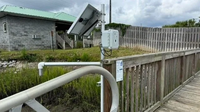
Water Level Monitoring Station at Turner Creek.
Photo courtesy of Prof. Russ Clark, CEAR Hub
Professor Russ Clark and his team have also demonstrated that Green Stream systems can be installed successfully by a capable local team. Green Stream provides the equipment, cloud platform, guidance and ongoing support; local partners contribute their knowledge of the community and field conditions.
We especially enjoy working with the Georgia Tech team because they combine a serious commitment to protecting coastal Georgians with genuine joy in the work. We are inspired by their work and pleased to support them as they expand this important community resource.
Read the CEAR Hub’s article: “Closing the Gap: How Smart Sensors Are Changing Coastal Flood Monitoring in Georgia.”