Satellite Connectivity for Flood Monitoring Resilience
Many of the communities most vulnerable to flooding are also the hardest to connect. Rural river crossings, coastal marshes, isolated floodplains, and low-lying transportation corridors often have weak cellular coverage — or lose connectivity during severe weather events.
For Green Stream, communications reliability is central to flood warning. A water level sensor only provides value if the data reaches emergency managers, public works officials, and transportation agencies in time to act.
To address this challenge, Green Stream offers both LTE and Iridium satellite communications depending on the needs of the monitoring site. Cellular connectivity is often the most practical solution where coverage is strong. In remote areas — or in regions concerned about communications outages during hurricanes and major storms — satellite connectivity provides an additional layer of resilience.
Green Stream selected Ground Control’s RockBLOCK Iridium devices because they provided a practical and reliable way to integrate satellite communications into its monitoring systems quickly.
Satellite communications help extend flood monitoring into underserved areas where traditional connectivity may be limited. By combining rugged sensor systems, autonomous solar power, secure cloud services, dashboards, alerts, APIs, and flexible telemetry options, Green Stream helps communities maintain situational awareness when conditions are changing rapidly.
Read Ground Control’s full story about the partnership here.
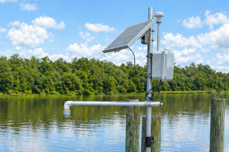
Monitoring flooding in a coastal tribal territory. Iridium communications provide reliable connectivity.